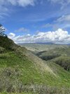
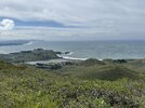
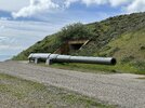
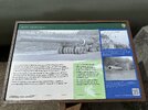
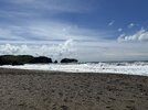
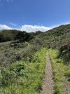
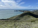
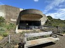
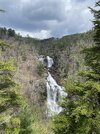
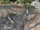
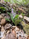
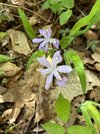
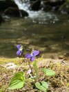
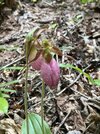
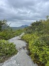
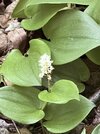
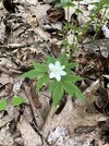
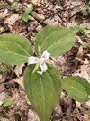
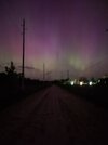
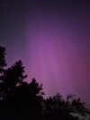
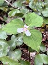
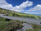
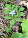
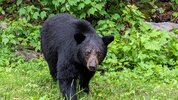
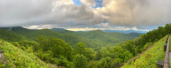
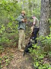
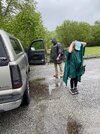
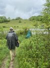
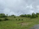
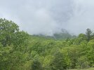
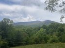
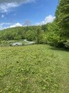
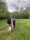
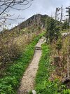
And in an old-school-cool Large ALICE...I like the vibe!Bryson City NC, Hiked 5 miles up Deep Creek Trail and back to do some trout fishing. No luck fishing, but it was enjoyed all the same
View attachment 760440
View attachment 760441
View attachment 760442
View attachment 760443
You are using an out of date browser. It may not display this or other websites correctly.
You should upgrade or use an alternative browser.
You should upgrade or use an alternative browser.
Post your recent hiking pics
- Thread starter chiefjason
- Start date
- Replies 559
- Views 13,647
Bryson City NC, Hiked 5 miles up Deep Creek Trail and back to do some trout fishing. No luck fishing, but it was enjoyed all the same
View attachment 760440
View attachment 760441
View attachment 760442
View attachment 760443
Based on the curl on the Rhodos it might have been too cold for a rooster tail. I'd be going nymph on a fly rod. Which is what I'll likely be fishing Thur/Fri when I'm out. Deep and slow until it gets warm.
Nice area to be out and about in though.
Something a bit different. Instead of a straight hiking video I did more of a highlight reel of our overnight hike into Gragg Prong and Lost Cove. It was my wife's first time back to backpacking since before she was pregnant with our oldest. It was about 7.5 miles total. Going to do a separate vid of the flowers.
Got the wildflower vid up.
couple of pics as well. The OR hat I got in college and while talking about it here I realized it’s been on every single backpacking trip since as well as most of my day hikes and a lot of fishing trips. Retested it last year. Still works.
And the narrow gauge railroad line was pretty cool on the side of the trail.
And a couple shots playing around with the low light camera.

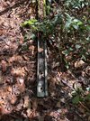
And the narrow gauge railroad line was pretty cool on the side of the trail.
And a couple shots playing around with the low light camera.


cubrock
Swell guy
2A Bourbon Hound 2024
2A Bourbon Hound OG
Charter Life Member
Benefactor
Multi-Factor Enabled
Did 8 miles on Grandfather Mountain with two of the boys. Weather was about perfect. Started off chilly, but the ascent kept us warm. We did the Profile Trail up to Calloway Peak and back. I was shocked how many people were on the trail. When we arrived at the parking area around 8 AM, we were one of 6 or 8 vehicles. When we got back around 1, a ranger was turning people away because the lot was full.
Things are starting to bud up there, but no blooms.
It was a humbling beginning to the hiking season. I had to work a lot harder than I thought I would. Of course, Profile is around 4 miles of mostly UP, so there is that. Also, trying to keep up with the boys wears me out in a hurry. lol
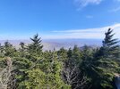
View from the top:
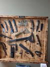
On the way home, we stopped at Winkler Knives’ showroom. That was really neat. They have a museum of Winkler’s knives that have been in movies and on special forces missions, including the tomahawk that was there when Saddam Hussein was captured. Also a board of various projects he has done for military and LE agencies. Really nice folks, too.
Things are starting to bud up there, but no blooms.
It was a humbling beginning to the hiking season. I had to work a lot harder than I thought I would. Of course, Profile is around 4 miles of mostly UP, so there is that. Also, trying to keep up with the boys wears me out in a hurry. lol
View from the top:

On the way home, we stopped at Winkler Knives’ showroom. That was really neat. They have a museum of Winkler’s knives that have been in movies and on special forces missions, including the tomahawk that was there when Saddam Hussein was captured. Also a board of various projects he has done for military and LE agencies. Really nice folks, too.

@chiefjason -
I skimmed the video you posted and will try to watch it all later. I got a cold shiver when you posted the panning shot of Hunt Fish Falls... 🥶 I fell in there in the early 90s. I can't recall the month, but my buddy (who still laughs about it to this day) says he thinks it was October(?) but I know it was cool (we only hiked from October to March).
We had just came down the primary trail from the parking area, and I walked over to overlook the pool and said "I'm going to get a closer look". I was wearing khaki pants and a pair of worn-out Hi-Tec Magnums (old duty boots) that I knew were slick, but DANG they were as comfortable as bedroom slippers! I took about two steps and I heard my buddy say "Just don't get TOO close a look!" and that's when both feet slipped and I hit on my butt. I began sliding down and it seemed to take several seconds before I hit. Just before I hit the water-all I could think was the cold shock and was praying "God just don't let me pass out!" I hit and came up once but was deep enough that my my feet didn't catch any ground and went back under. I'm not a good swimmer at all (but am a former SCUBA diver-let that sink in...lol) but I gave it a couple of hard strokes and this time came up on a sand bar and was able to stand. My buddy was already trying hard to get downstream of me and I yelled that I was good and to stop (didn't need TWO casualties.) I made my way to the bank and climbed the hill back up to the trail. The water was so cold that I was already getting stiff fingers and felt the cold "stinging" me. He asked if we needed to head back to the truck and I thought about it...not gonna lie I was ready to call it, BUT I recalled having a pair of Tevas and a spare pair of pants in my day pack (which miraculously was still dry inside-I hadn't went under long enough for water to enter it!) I told him I thought I would be okay.
When we looked in both directions and saw no one coming, I began stripping off completely nekkid right there on the trail and changed into the spare clothes I'd packed, and we went on with the hike (to the large clearing just below the falls) and and made a "day" camp.
To this day, I still recall that cold water and the burning/stinging feeling and getting stiff before I could get the wet clothes off-and this was in October! Not December, January, February, etc. I have a healthy respect for how quick one can end up in the water AND how hypothermia can work on you.
@cubrock - Glad you posted about Winkler. I've got a couple of his knives and I love that "Western NC DNA" they possess. I was only in the retail store for the first time a couple weeks ago however. Nice place and the guy and gal that were there (Bruce and wife Heather) when I was there were really personable.
Last edited:
cubrock
Swell guy
2A Bourbon Hound 2024
2A Bourbon Hound OG
Charter Life Member
Benefactor
Multi-Factor Enabled
@chiefjason -
I skimmed the video you posted and will try to watch it all later. I got a cold shiver when you posted the panning shot of Hunt Fish Falls... 🥶 I fell in there in the early 90s. I can't recall the month, but my buddy (who still laughs about it to this day) says he thinks it was October(?) but I know it was cool (we only hiked from October to March).
We had just came down the primary trail from the parking area, and I walked over to overlook the pool and said "I'm going to get a closer look". I was wearing khaki pants and a pair of worn-out Hi-Tec Magnums (old duty boots) that I knew were slick, but DANG they were as comfortable as bedroom slippers! I took about two steps and I heard my buddy say "Just don't get TOO close a look!" and that's when both feet slipped and I hit on my butt. I began sliding down and it seemed to take several seconds before I hit. Just before I hit the water-all I could think was the cold shock and was praying "God just don't let me pass out!" I hit and came up once but was deep enough that my my feet didn't catch any ground and went back under. I'm not a good swimmer at all (but am a former SCUBA diver-let that sink in...lol) but I gave it a couple of hard strokes and this time came up on a sand bar and was able to stand. My buddy was already trying hard to get downstream of me and I yelled that I was good and to stop (didn't need TWO casualties.) I made my way to the bank and climbed the hill back up to the trail. The water was so cold that I was already getting stiff fingers and felt the cold "stinging" me. He asked if we needed to head back to the truck and I thought about it...not gonna lie I was ready to call it, BUT I recalled having a pair of Tevas and a spare pair of pants in my day pack (which miraculously was still dry inside-I hadn't went under long enough for water to enter it!) I told him I thought I would be okay.
When we looked in both directions and saw no one coming, I began stripping off completely nekkid right there on the trail and changed into the spare clothes I'd packed, and we went on with the hike (to the large clearing just below the falls) and and made a "day" camp.
To this day, I still recall that cold water and the burning/stinging feeling and getting stiff before I could get the wet clothes off-and this was in October! Not December, January, February, etc. I have a healthy respect for how quick one can end up in the water AND how hypothermia can work on you.
@cubrock - Glad you posted about Winkler. I've got a couple of his knives and I love that "Western NC DNA" they possess. I was only in the retail store for the first time a couple weeks ago however. Nice place and the guy and gal that were there (Bruce and wife Heather) when I was there were really personable.
We met Bruce and Heather. Really nice folks. Bruce and my knife making son talked shop for quite a while.
@chiefjason -
I skimmed the video you posted and will try to watch it all later. I got a cold shiver when you posted the panning shot of Hunt Fish Falls... 🥶 I fell in there in the early 90s. I can't recall the month, but my buddy (who still laughs about it to this day) says he thinks it was October(?) but I know it was cool (we only hiked from October to March).
We had just came down the primary trail from the parking area, and I walked over to overlook the pool and said "I'm going to get a closer look". I was wearing khaki pants and a pair of worn-out Hi-Tec Magnums (old duty boots) that I knew were slick, but DANG they were as comfortable as bedroom slippers! I took about two steps and I heard my buddy say "Just don't get TOO close a look!" and that's when both feet slipped and I hit on my butt. I began sliding down and it seemed to take several seconds before I hit. Just before I hit the water-all I could think was the cold shock and was praying "God just don't let me pass out!" I hit and came up once but was deep enough that my my feet didn't catch any ground and went back under. I'm not a good swimmer at all (but am a former SCUBA diver-let that sink in...lol) but I gave it a couple of hard strokes and this time came up on a sand bar and was able to stand. My buddy was already trying hard to get downstream of me and I yelled that I was good and to stop (didn't need TWO casualties.) I made my way to the bank and climbed the hill back up to the trail. The water was so cold that I was already getting stiff fingers and felt the cold "stinging" me. He asked if we needed to head back to the truck and I thought about it...not gonna lie I was ready to call it, BUT I recalled having a pair of Tevas and a spare pair of pants in my day pack (which miraculously was still dry inside-I hadn't went under long enough for water to enter it!) I told him I thought I would be okay.
When we looked in both directions and saw no one coming, I began stripping off completely nekkid right there on the trail and changed into the spare clothes I'd packed, and we went on with the hike (to the large clearing just below the falls) and and made a "day" camp.
To this day, I still recall that cold water and the burning/stinging feeling and getting stiff before I could get the wet clothes off-and this was in October! Not December, January, February, etc. I have a healthy respect for how quick one can end up in the water AND how hypothermia can work on you.
@cubrock - Glad you posted about Winkler. I've got a couple of his knives and I love that "Western NC DNA" they possess. I was only in the retail store for the first time a couple weeks ago however. Nice place and the guy and gal that were there (Bruce and wife Heather) when I was there were really personable.
Good news. It's still cold. lol. I didn't get in far, but I did wet wade and fish about 30 minutes. I was colder than I had hoped and only had one fish bump it before I got a mess of a tangle on my double nymph and just called it a day.
That rock is steep at the bottom and wet in places. I'll post about it later by we both took a fall there and I was worried I might got for a ride too.
cubrock
Swell guy
2A Bourbon Hound 2024
2A Bourbon Hound OG
Charter Life Member
Benefactor
Multi-Factor Enabled
Hiked 6.2 miles from Bad Creek to the upper Whitewater falls and back on Monday.
View attachment 763475
What is the elevation change like over that stretch?
My hiking app glitched right before we reached the last “staircase”. Up to that point we had gained 780 feet. That last set of steps is a beast.What is the elevation change like over that stretch?
ETA: Alltrails (not my app) has it at 1174’ elevation gain.
Last edited:
cubrock
Swell guy
2A Bourbon Hound 2024
2A Bourbon Hound OG
Charter Life Member
Benefactor
Multi-Factor Enabled
My hiking app glitched right before we reached the last “staircase”. Up to that point we had gained 780 feet. That last set of steps is a beast.
ETA: Alltrails (not my app) has it at 1174’ elevation gain.
Thanks. Adding this one to my list and wanted to have an idea what it was like.
My wife loves the picture you took. Looks like it belongs in a calendar.
We talked about next time doing this as a vehicle drop hike starting at the upper falls, hiking downhill to the lower falls then out at the Bad Creek parking lot. Hiking to the lower falls adds about 3 miles to the trek.Thanks. Adding this one to my list and wanted to have an idea what it was like.
My wife loves the picture you took. Looks like it belongs in a calendar.
Hiked about 7 miles in South Mountains State Park. Chestnut Knob, Sawtooth Trail, and CC trail.
cubrock
Swell guy
2A Bourbon Hound 2024
2A Bourbon Hound OG
Charter Life Member
Benefactor
Multi-Factor Enabled
Hiked Lake View Trail around Broughton Reservoir today. 1.5 miles. Nice trail.
View attachment 774378View attachment 774379View attachment 774380
I’ve never hiked that one. Very nice pics!
I’ve never hiked that one. Very nice pics!
There is a little longer out and back trail up the creek too. Little over 2 miles to the top of the creek. Going to go back when we have more time and check that one out. Got a longer vid of the entire loop on my channel. Roughly 36 minutes of actual hiking around the lake.
cubrock
Swell guy
2A Bourbon Hound 2024
2A Bourbon Hound OG
Charter Life Member
Benefactor
Multi-Factor Enabled
Now that my daughter’s 10K is behind us, I’ve switched over from running training to hiking training. Did 11 miles in Linville Gorge today. With the possible closure of the Wolf Pit trailhead come June, I thought I’d try an alternate trailhead to access Shortoff Mountain. I parked at the Fonta Flora trail parking lot located on NC 126 at Wolf Pit Road and hiked the MST Connector trail over to the MST, up the MST to the top of Shortoff, then back down the MST to a gameland connector trail that roughly parallels the MST connector trail back to the parking area. Did 11 miles total. Could have hiked more easy miles on Shortoff, but since this is my first big training hike, I didn’t want to overdo it. I'm glad I didn't - I was wiped out enough by the end.
First of all, the Fonta Flora/MST connector trail is very nice. Has some ups and downs, but nothing horrible. Scenery was beautiful and it parallels the Linville River for a good ways. Would be a pretty decent fishing trail, even if you have part of a collapsed rod sticking out your pack. It was fairly clear overhead much of the way. Parts of it remind me a lot of South Mountain State Park. There were a couple decent swimming holes I saw in the river along the way, too. One could make a fun day hike out of it with swimming, fishing, picnicking, etc. Just have to carry your stuff in and out, but the trail was easy enough that that wouldn't be that bad for anyone in reasonable shape and doable for most if you pace yourself. Even if you just want a pretty, mostly shaded 5.5ish mile hike, you could certainly do worse, at least until it gets within about a half mile of the MST. At that point, it gets steep as it climbs into a burnover area and isn't as pretty, shady, or easy that last half mile or so of the connector. But, if you turn around at the 2.7ish mark, you don't get into that last ugly half mile.
But once you get to the MST, oh my goodness, does it get hard. 1.2 miles of suck - literally - as in sucking wind. This ain't my first rodeo on this section of the MST. I've done it a few other times, but it sure wasn't any easier on me now than before, even though I am arguably in better shape, definitely weigh less, and was carrying less pack than when I did that part the last time, about a year ago. Whoever cut this section of the MST did not believe in switchbacks. There are none. There are a few little wiggles in the trail as it climbs a ridge towards Shortoff Mountain. You get a few breaks where the grade flattens out somewhat for a bit, and there are a couple smallish areas where fires of the past didn't kill all the big trees, but it is mostly UP with minimal shade. Thankfully, today wasn't too hot, but it was hot enough. Those 1.2 miles took me 50 minutes, which was a touch on the humbling side. They took me 36 minutes coming down, which was more painful in the joints than going up and a hard workout in its own right.
Once the MST joins the Shortoff Mountain trail, there is a shorter section of suck as you finish the ascent up Shortoff with some masterfully made, but difficult, trail stairs made of native rock and dirt. My hat is off to whomever did these stairs decades ago. They have really stood the test of time, but that doesn't make them any easier to climb.
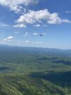
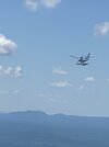
I stopped at Unbelievable Point for a snack and drink. Took the pack off and rested for 15 or 20 minutes - my first break since starting the hike. I was 4.88 miles in at that point, according to Avenza. While I sat there, a seaplane buzzed by as it flew out of the Gorge towards Lake James. It was close enough, someone with a good arm could have hit it with a rock. No exaggeration. He was CLOSE to the cliff face and maybe 20-30 feet higher than where I sat. Could easily see the pilot's face. He drifted down to the lake and landed in the middle of the closest arm to the mountain. You could see the white of his splashdown. Then it subsided and he floated for several minutes. A dark shape that looked like it was a boat moved out toward him, but it was impossible to see at that distance whether it stopped where he was or was just passing through. Eventually, the white surrounded him again as he started moving to take off and he flew away somewhere. It was really neat to see.
Saw very little wildlife - some birds and lizards. Still a lot of flowers blooming. The blueberry bushes have small, unripe berries which will be yummy trail snacks here in several weeks. Blackberries are just flowering up there, which will be yummy trail snacks after the blueberries are gone.
I did the hike in a skosh over 5 hours, so my average pace, including stops, was a bit over 2 miles an hour. I was pleased with that, given how long the MST climb took. I carried extra water so I wouldn't have to filter any, which saved me some time. I broke in a new pair of hiking shoes, too, which went well. Got a couple hot spots as I figured out the ideal lacing tightness, but they performed mostly as I need them to. Any time I can do an extended hike at an average of 2 miles an hour over varied terrain, I'm satisfied. On backpacking trips, 2 mph is a pretty decent average pace and allows one to cover a lot of ground in a day, when needed.
This route has its own appeal, but it is frustrating to think that it might have to replace routes starting at Wolf Pit, as it adds over 5 miles total to any hike we would normally do that goes up Shortoff. Last year, my most used training hike was Wolfpit to Table Rock parking area, which is right at 14 miles and has two tough ascents that were great for training. Doing that hike from the NC-126 parking area would be nearly 20 miles, which I have done in a single day, but is not something I have the time and hiking chops to do regularly, especially given the Shortoff ascent would be much harder than when starting from Wolf Pit.
Guess we will see how things shake out with the potential trail head closure in June.
Pics below, in hike order:
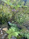
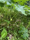
Mountain laurel (?) blooming on the connector trail.

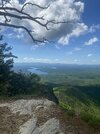
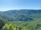
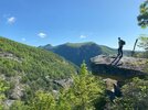
Lake James from Unbelievable Point. The green ridge just right of center at the bottom is the ridge the MST climbs straight up from the Linville River. Toughest section of this hike by far.
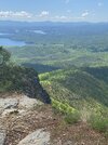
Better view of part of the MST ridge.
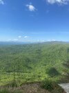
Sea plane after he passed us. Camera wasn’t handy as he came by.
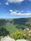
Across the gorge.
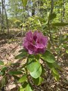
More blooms on Shortoff.
Headed down the mountain again. The MST breaks off the Shortoff trail here to the right. The fun begins again, only downhill this way. Ugh.
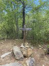
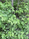
Trail snacks to come….
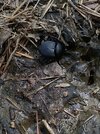
I passed a pile of bear scat in the trail on the way up the MST. When I came down, a dung beetle had found it and was doing what dung beetles do.
View of Shortoff from the gameland trail that I hiked back to the trailhead.
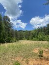
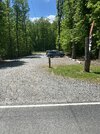
Was so glad of this sight!
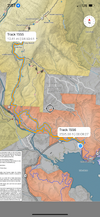
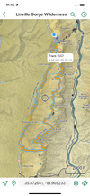
Avenza lost GPS signal towards the end of the hike and I had to start a new track. Total mileage was right at 11 miles in reality. Minimum elevation was 1209’, max 2993’. Lots more total elevation gain than that given the ups and downs.
First of all, the Fonta Flora/MST connector trail is very nice. Has some ups and downs, but nothing horrible. Scenery was beautiful and it parallels the Linville River for a good ways. Would be a pretty decent fishing trail, even if you have part of a collapsed rod sticking out your pack. It was fairly clear overhead much of the way. Parts of it remind me a lot of South Mountain State Park. There were a couple decent swimming holes I saw in the river along the way, too. One could make a fun day hike out of it with swimming, fishing, picnicking, etc. Just have to carry your stuff in and out, but the trail was easy enough that that wouldn't be that bad for anyone in reasonable shape and doable for most if you pace yourself. Even if you just want a pretty, mostly shaded 5.5ish mile hike, you could certainly do worse, at least until it gets within about a half mile of the MST. At that point, it gets steep as it climbs into a burnover area and isn't as pretty, shady, or easy that last half mile or so of the connector. But, if you turn around at the 2.7ish mark, you don't get into that last ugly half mile.
But once you get to the MST, oh my goodness, does it get hard. 1.2 miles of suck - literally - as in sucking wind. This ain't my first rodeo on this section of the MST. I've done it a few other times, but it sure wasn't any easier on me now than before, even though I am arguably in better shape, definitely weigh less, and was carrying less pack than when I did that part the last time, about a year ago. Whoever cut this section of the MST did not believe in switchbacks. There are none. There are a few little wiggles in the trail as it climbs a ridge towards Shortoff Mountain. You get a few breaks where the grade flattens out somewhat for a bit, and there are a couple smallish areas where fires of the past didn't kill all the big trees, but it is mostly UP with minimal shade. Thankfully, today wasn't too hot, but it was hot enough. Those 1.2 miles took me 50 minutes, which was a touch on the humbling side. They took me 36 minutes coming down, which was more painful in the joints than going up and a hard workout in its own right.
Once the MST joins the Shortoff Mountain trail, there is a shorter section of suck as you finish the ascent up Shortoff with some masterfully made, but difficult, trail stairs made of native rock and dirt. My hat is off to whomever did these stairs decades ago. They have really stood the test of time, but that doesn't make them any easier to climb.
I stopped at Unbelievable Point for a snack and drink. Took the pack off and rested for 15 or 20 minutes - my first break since starting the hike. I was 4.88 miles in at that point, according to Avenza. While I sat there, a seaplane buzzed by as it flew out of the Gorge towards Lake James. It was close enough, someone with a good arm could have hit it with a rock. No exaggeration. He was CLOSE to the cliff face and maybe 20-30 feet higher than where I sat. Could easily see the pilot's face. He drifted down to the lake and landed in the middle of the closest arm to the mountain. You could see the white of his splashdown. Then it subsided and he floated for several minutes. A dark shape that looked like it was a boat moved out toward him, but it was impossible to see at that distance whether it stopped where he was or was just passing through. Eventually, the white surrounded him again as he started moving to take off and he flew away somewhere. It was really neat to see.
Saw very little wildlife - some birds and lizards. Still a lot of flowers blooming. The blueberry bushes have small, unripe berries which will be yummy trail snacks here in several weeks. Blackberries are just flowering up there, which will be yummy trail snacks after the blueberries are gone.
I did the hike in a skosh over 5 hours, so my average pace, including stops, was a bit over 2 miles an hour. I was pleased with that, given how long the MST climb took. I carried extra water so I wouldn't have to filter any, which saved me some time. I broke in a new pair of hiking shoes, too, which went well. Got a couple hot spots as I figured out the ideal lacing tightness, but they performed mostly as I need them to. Any time I can do an extended hike at an average of 2 miles an hour over varied terrain, I'm satisfied. On backpacking trips, 2 mph is a pretty decent average pace and allows one to cover a lot of ground in a day, when needed.
This route has its own appeal, but it is frustrating to think that it might have to replace routes starting at Wolf Pit, as it adds over 5 miles total to any hike we would normally do that goes up Shortoff. Last year, my most used training hike was Wolfpit to Table Rock parking area, which is right at 14 miles and has two tough ascents that were great for training. Doing that hike from the NC-126 parking area would be nearly 20 miles, which I have done in a single day, but is not something I have the time and hiking chops to do regularly, especially given the Shortoff ascent would be much harder than when starting from Wolf Pit.
Guess we will see how things shake out with the potential trail head closure in June.
Pics below, in hike order:
Mountain laurel (?) blooming on the connector trail.


Lake James from Unbelievable Point. The green ridge just right of center at the bottom is the ridge the MST climbs straight up from the Linville River. Toughest section of this hike by far.

Better view of part of the MST ridge.


Sea plane after he passed us. Camera wasn’t handy as he came by.


Across the gorge.

More blooms on Shortoff.

Headed down the mountain again. The MST breaks off the Shortoff trail here to the right. The fun begins again, only downhill this way. Ugh.

Trail snacks to come….

I passed a pile of bear scat in the trail on the way up the MST. When I came down, a dung beetle had found it and was doing what dung beetles do.

View of Shortoff from the gameland trail that I hiked back to the trailhead.


Was so glad of this sight!

Avenza lost GPS signal towards the end of the hike and I had to start a new track. Total mileage was right at 11 miles in reality. Minimum elevation was 1209’, max 2993’. Lots more total elevation gain than that given the ups and downs.

Last edited:
cubrock
Swell guy
2A Bourbon Hound 2024
2A Bourbon Hound OG
Charter Life Member
Benefactor
Multi-Factor Enabled
Took the hiking machines (my two youngest boys) to Linville Gorge to hike the Rock Jock trail today. First time for all three of us. We spend much more time on the eastern rim of the Gorge since it is closer to where we live. We started at Conley Cove, hiked south on Rock Jock, then back up to Conley Cove trailhead along Kistler.
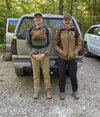
Today was cool at the outset with low humidity, but it was amazing how quickly their jackets came off:
Accidentally wound up at the overlook at Lost Dog Pond Camp, which was a welcome surprise. We had planned to bypass it, but I took a wrong turn on the middle trail going into the camp. So, technically, we haven't done the WHOLE Rock Jock trail. We missed a small section between the middle and last camp trails at Lost Dog Pond.
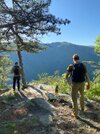
Hacker's Point was one of the things I really wanted to see, having seen so many people post pictures from there. I was disappointed to discover that the gnarled, dead tree in so many of those pictures has broken off at the base. At least I assume that is what happened. No gnarled, dead tree - just a broken off stump. Still, the view there is incredible.
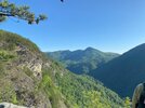
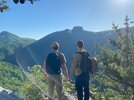
On down the trail, one of the boys found a Blue Jay feather. Believe it or not, we had just arrived at Blue Jay Falls! Can't make this stuff up. He put it in his pack to take home and put in an old bottle in which he keeps cool finds.
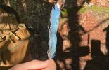
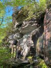
I admit, Rock Jock, on the whole, turned out to be easier and less, well, rocky than I expected. But, it had its moments. Pictures can't adequately show how steep parts of the trail are. And, after the rain we have had, some of the mud got pretty slick. I was the only one to take a spill, and thankfully a mild one, at that. Didn't get a picture of the spill, but here is one stretch of really steep trail:
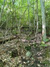
The boys liked this part and thought they were finally going to get to see what they expected from a trail named "Rock Jock."
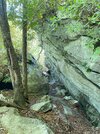
Today was a day to hike the trail and we decided to leave most of the points and other hidden gems for another day or three. Still, some of the unnamed views were amazing. Below is a view across the Gorge towards Cambric Branch/Cambric Trail and another of the Amphitheater from the Mossy Canyon area.
We eventually arrived at the last 4/10 mile or so of the trail where you have to climb, nearly straight up, to get back up to Kistler. I watched the left side of the trail for hints of any old bushwhack trails that would connect to Pinch In. I saw one towards the bottom of the ascent that was exactly where I would start such a bushwhack, just from studying the map. Found a second one a little ways up that matches a bushwhack from a trail report map from ten or so years back. Then a third one that had some old branches laid across the head of it like someone was discouraging anyone from wandering down that way. Seems like such a connector would be a very handy trail.
The 3-ish miles back to the truck were pretty pleasant for a road hike. There were several car campers along the way. We stopped and talked to a couple of them. The hike up Dogback Mountain was steep, but easier than the climb up the last bit of Rock Jock. We made it to the truck in 50 minutes, which made me pretty happy. I was able to keep up with the boys AND talk comfortably the whole way. I'm cognizant of the precious little time I have left with them before they fully spread their wings and go their own way, so quality time together like this is a treasure.
We had come in from the south side of Kistler, so we drove home going north on Kistler and picked up 183 to 181. Much of Kistler is in great shape, but there were some stretches that made me glad I drove my 4X4, due to ground clearance moreso than traction. The road was ROUGH in places - rough enough I don't think a standard car would have been able to get through without a lot of chassis dragging and possibly even getting stuck.
Thanks to all the Gorge Rats that have gone before and pioneered and mapped all these great trails. We are doing our part to not only enjoy the fruits of your labor, but preserve it and pass it on to future generations.

Today was cool at the outset with low humidity, but it was amazing how quickly their jackets came off:

Accidentally wound up at the overlook at Lost Dog Pond Camp, which was a welcome surprise. We had planned to bypass it, but I took a wrong turn on the middle trail going into the camp. So, technically, we haven't done the WHOLE Rock Jock trail. We missed a small section between the middle and last camp trails at Lost Dog Pond.

Hacker's Point was one of the things I really wanted to see, having seen so many people post pictures from there. I was disappointed to discover that the gnarled, dead tree in so many of those pictures has broken off at the base. At least I assume that is what happened. No gnarled, dead tree - just a broken off stump. Still, the view there is incredible.


On down the trail, one of the boys found a Blue Jay feather. Believe it or not, we had just arrived at Blue Jay Falls! Can't make this stuff up. He put it in his pack to take home and put in an old bottle in which he keeps cool finds.


I admit, Rock Jock, on the whole, turned out to be easier and less, well, rocky than I expected. But, it had its moments. Pictures can't adequately show how steep parts of the trail are. And, after the rain we have had, some of the mud got pretty slick. I was the only one to take a spill, and thankfully a mild one, at that. Didn't get a picture of the spill, but here is one stretch of really steep trail:

The boys liked this part and thought they were finally going to get to see what they expected from a trail named "Rock Jock."

Today was a day to hike the trail and we decided to leave most of the points and other hidden gems for another day or three. Still, some of the unnamed views were amazing. Below is a view across the Gorge towards Cambric Branch/Cambric Trail and another of the Amphitheater from the Mossy Canyon area.


We eventually arrived at the last 4/10 mile or so of the trail where you have to climb, nearly straight up, to get back up to Kistler. I watched the left side of the trail for hints of any old bushwhack trails that would connect to Pinch In. I saw one towards the bottom of the ascent that was exactly where I would start such a bushwhack, just from studying the map. Found a second one a little ways up that matches a bushwhack from a trail report map from ten or so years back. Then a third one that had some old branches laid across the head of it like someone was discouraging anyone from wandering down that way. Seems like such a connector would be a very handy trail.
The 3-ish miles back to the truck were pretty pleasant for a road hike. There were several car campers along the way. We stopped and talked to a couple of them. The hike up Dogback Mountain was steep, but easier than the climb up the last bit of Rock Jock. We made it to the truck in 50 minutes, which made me pretty happy. I was able to keep up with the boys AND talk comfortably the whole way. I'm cognizant of the precious little time I have left with them before they fully spread their wings and go their own way, so quality time together like this is a treasure.
We had come in from the south side of Kistler, so we drove home going north on Kistler and picked up 183 to 181. Much of Kistler is in great shape, but there were some stretches that made me glad I drove my 4X4, due to ground clearance moreso than traction. The road was ROUGH in places - rough enough I don't think a standard car would have been able to get through without a lot of chassis dragging and possibly even getting stuck.
Thanks to all the Gorge Rats that have gone before and pioneered and mapped all these great trails. We are doing our part to not only enjoy the fruits of your labor, but preserve it and pass it on to future generations.

Last edited:
cubrock
Swell guy
2A Bourbon Hound 2024
2A Bourbon Hound OG
Charter Life Member
Benefactor
Multi-Factor Enabled
Forgot to add that we saw a turkey hen on Old NC 105 driving to the trailhead. Then, a short distance later, we saw a bobcat in the road, who quickly skedaddled into brush when we approached. The boys were very impressed with the bobcat. Don’t see them every day.
Kalashnicarolina
Well-Known Member
cubrock
Swell guy
2A Bourbon Hound 2024
2A Bourbon Hound OG
Charter Life Member
Benefactor
Multi-Factor Enabled
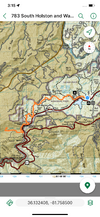
Did around 14.5 miles or so near Grandfather Mountain with my youngest two today. Wanted to stay off rougher trails due to the rain, so we started at Price Park and took the southern part of the Boone Fork loop to the Tanawha Trail, Tanawha to Nuwati Trail, Nuwati Trail to Storyteller Rock. Then, back the way we came.
We hit the trail about an hour and a half later than planned. It started raining right away. Out came the ponchos and we hiked in light to moderate rain for a few miles. The rain slacked off and the sun came out after that, so we packed the ponchos away and kept going.
Our initial plan had been to hike to Boone Fork parking lot on the Parkway and turn around there. I estimated this would give us about a 13 mile day. However, when we arrived, GPS said we had hiked only 5.5 miles. My distance estimates were based off waypoints in the Mountains-to-Sea Trail app and the waypoint in Price Park I used was farther along than where we had started. So, we decided to continue hiking to get more miles and see Storyteller Rock, which we had never hiked to before.
We got to Storyteller Rock just after noon and sat on it to eat lunch. I mentioned to the kids that we needed to eat fast since it had gotten really cloudy again. My son looked up toward the top of Grandfather Mountain and pointed out it was raining up there and descending fast towards us. So, we scarfed everything down and got our gear on, put on our ponchos, and got off the rock just before we were hit by a thunderstorm. Amazing how fast those things move in the mountains. We hiked the next mile or so with hard rain, lightning flashing, and thunder booming, but it passed within about half an hour.
Not long after, the sun came out again, so we stowed our ponchos. We hiked back to Price Park to get hit by another heavy storm right after we got in the truck. POURING rain. Talk about good timing.
14.5ish miles in 5 hours 52 minutes. This hike was easier trail than we often do, but I was pretty pleased with that time nonetheless.
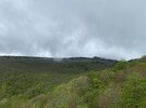
Rain from the get go
Couple miles in, crossing Holloway Mountain Road. We use this parking area/trailhead a lot on other hikes.
Not far from Holloway Mountain Road is a great view of Grandfather Mountain, when it isn’t hiding in clouds.
Sun is out!
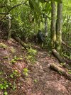
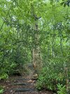
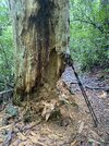
Dead tree along Tanawha that bear and woodpeckers have carved out looking for various critters to eat. It is going to fall some day.
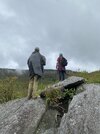
Storyteller Rock. Has amazing views of Grandfather Mountain.
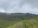
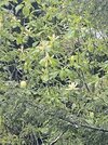
Took this with full zoom. Not sure what tree this is. Couldn’t tell at that distance if it is buckeye. Pretty though.
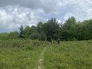
Sun came back out. This meadow is along the Tanawha Trail and is full of blackberries and an apple tree. We’ve eaten a lot of blackberries here, but never hiked through when the apples were ripe.
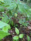
May apples were in bloom. In Linville Gorge, the blooms have already been replaced by fruit growing.
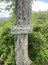
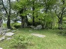
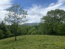
Back at the place near Holloway Mountain Road that has the great view of Grandfather. I like the weathered trail sign here. Also, there is a neat rock pile where we have seen people picnicking at this same spot. Grandfather decided to show himself to us as we hiked back through.
The kids are going through the gate to Holloway Mountain Road. This part of the trail is in a real deal cow pasture and we have had to gently coerce the cows out of our way more than once. Didn’t see them today, though.
Approaching the Price Park parking lot. Little did we know another thunderstorm was about to open up on us. Thankfully, we were already in the truck when it happened.
We hit the trail about an hour and a half later than planned. It started raining right away. Out came the ponchos and we hiked in light to moderate rain for a few miles. The rain slacked off and the sun came out after that, so we packed the ponchos away and kept going.
Our initial plan had been to hike to Boone Fork parking lot on the Parkway and turn around there. I estimated this would give us about a 13 mile day. However, when we arrived, GPS said we had hiked only 5.5 miles. My distance estimates were based off waypoints in the Mountains-to-Sea Trail app and the waypoint in Price Park I used was farther along than where we had started. So, we decided to continue hiking to get more miles and see Storyteller Rock, which we had never hiked to before.
We got to Storyteller Rock just after noon and sat on it to eat lunch. I mentioned to the kids that we needed to eat fast since it had gotten really cloudy again. My son looked up toward the top of Grandfather Mountain and pointed out it was raining up there and descending fast towards us. So, we scarfed everything down and got our gear on, put on our ponchos, and got off the rock just before we were hit by a thunderstorm. Amazing how fast those things move in the mountains. We hiked the next mile or so with hard rain, lightning flashing, and thunder booming, but it passed within about half an hour.
Not long after, the sun came out again, so we stowed our ponchos. We hiked back to Price Park to get hit by another heavy storm right after we got in the truck. POURING rain. Talk about good timing.
14.5ish miles in 5 hours 52 minutes. This hike was easier trail than we often do, but I was pretty pleased with that time nonetheless.

Rain from the get go

Couple miles in, crossing Holloway Mountain Road. We use this parking area/trailhead a lot on other hikes.


Not far from Holloway Mountain Road is a great view of Grandfather Mountain, when it isn’t hiding in clouds.

Sun is out!

Dead tree along Tanawha that bear and woodpeckers have carved out looking for various critters to eat. It is going to fall some day.


Storyteller Rock. Has amazing views of Grandfather Mountain.


Took this with full zoom. Not sure what tree this is. Couldn’t tell at that distance if it is buckeye. Pretty though.

Sun came back out. This meadow is along the Tanawha Trail and is full of blackberries and an apple tree. We’ve eaten a lot of blackberries here, but never hiked through when the apples were ripe.

May apples were in bloom. In Linville Gorge, the blooms have already been replaced by fruit growing.

Back at the place near Holloway Mountain Road that has the great view of Grandfather. I like the weathered trail sign here. Also, there is a neat rock pile where we have seen people picnicking at this same spot. Grandfather decided to show himself to us as we hiked back through.


The kids are going through the gate to Holloway Mountain Road. This part of the trail is in a real deal cow pasture and we have had to gently coerce the cows out of our way more than once. Didn’t see them today, though.

Approaching the Price Park parking lot. Little did we know another thunderstorm was about to open up on us. Thankfully, we were already in the truck when it happened.

Last edited:
Whoo, you guys are wearin’ me out — and I’m just readin’ about it
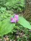
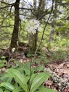
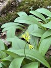
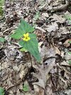
@cubrock That is a Fraser Magnolia blooming. Or by its proper name Magnolia Fraseri, which is kind of a 30 year running joke from my WEA course in college. The technical name stuck more than the real name because I got a chuckle out of it. A lot of time you can ID them by those very large leaves. Saw a lot of them blooming up there last weekend.
cubrock
Swell guy
2A Bourbon Hound 2024
2A Bourbon Hound OG
Charter Life Member
Benefactor
Multi-Factor Enabled
@cubrock That is a Fraser Magnolia blooming. Or by its proper name Magnolia Fraseri, which is kind of a 30 year running joke from my WEA course in college. The technical name stuck more than the real name because I got a chuckle out of it. A lot of time you can ID them by those very large leaves. Saw a lot of them blooming up there last weekend.
Thank you!
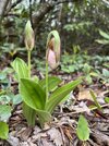
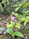
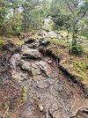
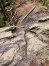
Went solo hiking today, for the first time...ever. I have just been against it having always heard and believed the wilderness can be dangerous and not going alone...etc. I have wanted to walk the Black Mountain Crest Trail for a long time but I know the whole thing is WAY out of my abilities (mid 50s, extremely obese although I do hike). The main things I wanted to do the BMCT for was the high peaks so I decided to at least walk to Big Tom from the Picnic Area. None of my hiking buddies could go so I decided to safely do it myself. It was SO nice initially and within a short distance I started down the two sections of created "steps" losing a lot of height quickly. I finally got to a great (but short) section that was like a postcard (me having seen it in pics on Alltrails). After that, it started climbing again. The trail was not as idyllic...  . It got steep and muddy. and a lot of rocks. I took my time and made it well enough...but finally got to a section I just wasn't comfortable descending by myself. I had hiking poles, but this was about 12-15 feet high, and at least a 45 degree angle if not steeper. There was groove down the middle I knew I'd likely turn my ankle if I tried to walk in or slide/flip if it caught my my foot. I knew I couldn't "walk" it even with the poles, and was going to have to "slide" down, and then it occurred to me I had to come BACK that way. I even tried to find a way around but it appeared that trail maintainers had created natural "fences" to prevent bushwhacking around it. I stood and looked at it for at least 5 minutes...trying to talk myself INTO it or OUT of it. Finally, deciding that discretion was the best part of valor, I turned back. I am kind of bummed about my abilities but confident I made the right call, especially alone. Maybe later (?)
STILL glad I spent several hours in the Black Mountains and on a trail today, instead of working or laying around the house. 👍
STILL glad I spent several hours in the Black Mountains and on a trail today, instead of working or laying around the house. 👍


cubrock
Swell guy
2A Bourbon Hound 2024
2A Bourbon Hound OG
Charter Life Member
Benefactor
Multi-Factor Enabled
Went solo hiking today, for the first time...ever. I have just been against it having always heard and believed the wilderness can be dangerous and not going alone...etc. I have wanted to walk the Black Mountain Crest Trail for a long time but I know the whole thing is WAY out of my abilities (mid 50s, extremely obese although I do hike). The main things I wanted to do the BMCT for was the high peaks so I decided to at least walk to Big Tom from the Picnic Area. None of my hiking buddies could go so I decided to safely do it myself. It was SO nice initially and within a short distance I started down the two sections of created "steps" losing a lot of height quickly. I finally got to a great (but short) section that was like a postcard (me having seen it in pics on Alltrails). After that, it started climbing again. The trail was not as idyllic.... It got steep and muddy. and a lot of rocks. I took my time and made it well enough...but finally got to a section I just wasn't comfortable descending by myself. I had hiking poles, but this was about 12-15 feet high, and at least a 45 degree angle if not steeper. There was groove down the middle I knew I'd likely turn my ankle if I tried to walk in or slide/flip if it caught my my foot. I knew I couldn't "walk" it even with the poles, and was going to have to "slide" down, and then it occurred to me I had to come BACK that way. I even tried to find a way around but it appeared that trail maintainers had created natural "fences" to prevent bushwhacking around it. I stood and looked at it for at least 5 minutes...trying to talk myself INTO it or OUT of it. Finally, deciding that discretion was the best part of valor, I turned back. I am kind of bummed about my abilities but confident I made the right call, especially alone. Maybe later (?)
STILL glad I spent several hours in the Black Mountains and on a trail today, instead of working or laying around the house. 👍
View attachment 781368
View attachment 781369
View attachment 781370
Nice! The BMCT is on my short list.
That's a great trail, however much you get to in one hike! I've not done it all; we cut down to the Buncombe Horse Range Trail & looped back to a lower parking spot where I'd left my truck, then I shuttled my buddy up to his car in the MM parking lot.
@Big Dave That trail does not get much better past that either. My wife has only made it out to Big Tom, so that's as far as I have been too. Was planning an overnight trip with my daughter but the weather didn't cooperate. So we went somewhere else. Don't get me wrong. I love that trail. You just have to be up to doing it, and sounds like you need a hiking partner next go around. If memory serves me that drop off is before you get out to the plane crash on the left.
9outof10mms
Enginerding, good coffee, and factual opinions.
2A Bourbon Hound 2024
Supporting Member
Multi-Factor Enabled


