It's Hurricane Season 2022.

Johnny

Larping Misanthropist
Supporting Member
Multi-Factor Enabled
Joined
Dec 19, 2016
Messages
20,855
Location
Pender County
Rating - 100%
8   0   0
Y'all wanna start keeping an eye on TS Ian.

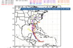
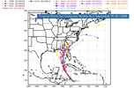
Looks like we will be likely getting a decent chunk of it Thursday/Friday. Pretty much every model that I'm seeing right now has it at cat 2 or 3 crossing over Florida mid state and either skirting the coast or just inland as a cat 1.
 
Y'all wanna start keeping an eye on TS Ian.

Looks like we will be likely getting a decent chunk of it Thursday/Friday. Pretty much every model that I'm seeing right now has it at cat 2 or 3 crossing over Florida mid state and either skirting the coast or just inland as a cat 1.

Damn, really?? Gotta start paying attention. I didn't know.
 
As of 9/24 looks like it may be visiting the central to western part of NC on into VA. Wind and rain would do a number on the fall foliage.
Be sure to be a Boy Scout this week.
 
WAY to early to get a solid prediction but speculation is landfall on the Redneck Riviera (late Thursday early Friday) and head north thru GA with a slight shift to the NNE. The NC/TN effects would be around Sunday???
 
WAY to early to get a solid prediction but speculation is landfall on the Redneck Riviera (late Thursday early Friday) and head north thru GA with a slight shift to the NNE. The NC/TN effects would be around Sunday???

That's pretty wild, substantial shift in the last 5 hours.
 
That's pretty wild, substantial shift in the last 5 hours.
And it WILL shift again … depending on what High or Low Fronts come into the picture and possibly shift it (especially as it approaches/makes land) in the next 4 …5 or so days. Hell it could be pushed east by a front and run up the GA/SC/NC coast.

61374078-AE84-4F98-B327-35D8E1EF048D.png
 
Last edited:
Have a friend in Florida and she’s getting first hand experience about not being prepared and worrying at the last minute

ETA: store shelves are already empty of stuff
 
It looks like we'll get a boatload of rain at least from Ian if it continues on the latest track that the weather models are showing. The Western parts of NC and SC would get the brunt of what's left of Ian after it comes inland. We could use the rain in the Central part of North Carolina but we do not need it to fall all at one time. There is still plenty of time to go before Ian arrives and it is certain that the forecasts will change between now and its arrival.
 
I can save you guys from guessing. I know exactly where it's going to go.

It's going to Kitty Hawk.

I have a house rented there 10/1 - 10/8.
Hope you got the cancellation insurance
 
And general consensus of the 5 day projection has shifted again … just slightly eastward … these guys love screwing with people …

1F8A0D70-49C5-499B-9805-DA80D674400D.png

… it’s going to be a funny week watching/listening to the panic and chaos this one stirs for the New Orleans to Tampa area for being its a target. I know it’s all about the rating but you also gotta wonder what holdings MSM executives and weathermen (especially the Weather Channel) have that they profit from panic buying?
 
Last edited:
Yup prepped everything except the bee hives. They will be gtg in the rain. I don’t expect winds to be high enough to warrant strapping them down.
Got 2 out of three generators running yesterday. I’ll have the third operational Monday. Got plenty of fuel, food and water.
 
Looks like a low pressure system will come across the upper Midwest later this coming week. Gonna be too late to push it away though.
 
Have a friend in Florida and she’s getting first hand experience about not being prepared and worrying at the last minute

ETA: store shelves are already empty of stuff

Worst case scenario is it hits the Tampa area as a high-cat storm. The further west it tracks, the less of a problem it will be and the faster it breaks down (too much cool and dry air).

This guy has a good analysis:

 
three times, he called the Western Tip of Cuba....the Western Tip of Florida.
 
I am supposed to work in New Bern this coming weekend so with my storm curse it will track east. That means depending on how bad it is supposed to be it will be rescheduled or I'll be working in the rain all day.
 
Evening update still favoring Euro model, looking at Tampa landfall with "potentially catastrophic surge." If it hits here, it will be a low pressure system and run through central NC with rain.
 
4H State Shooting Tournament is Saturday. If they cancel and/or move dates, it won't get here. If they so it's a go Saturday, it'll was us out. The anticipation sucks.
 
well, the good news for Saturday, so far, is every time i check
the forecast, Ian gets slower, which means the morning might
be ok. of course, a slow hurricane is a strong one.
 
Now they’ve shifted land fall east maybe glancing Tampa/St Pete along the way (Tampa better be gettin’ read for some major flooding on the surge) then tracking almost due north into GA … then a little East into the Carolinas. Most “experts” seem to say it will track East of the Appalachians but just how far East and when is still up in the air.
 
Worst case it hovers over Tampa for like 36 hours.
 
Worst case it hovers over Tampa for like 36 hours.
Tampa Bay is a disaster waiting to happen if the surge from hurricane force wind goes in like some have mentioned … 7-10 feet. I don’t think there are many places around the Bay that won’t have at least a couple feet of water if that happens and for a day or more?

Even worse in Florida … when major flooding occurs the Everglades and swamp creatures tend to come visiting.
 
I'm embarrassed, so looking forward to it.
That's race weekend also.

Where is the collectors show at? If its near the speedway, traffic should be "fun".
 
That's race weekend also.

Where is the collectors show at? If its near the speedway, traffic should be "fun".
Embassy Suites Charlotte-Concord
5400 John Q. Hammons Drive NW

Can't get much closer to the track than that :(
 
Back
Top Bottom